The Indonesian island of Java’s tallest volcano, Semeru, sent an ash cloud nearly a mile into the air this week—the latest uptick in unrest from a mountain that belches ash and volcanic gases almost constantly.
The latest explosive activity is par for the course for Semeru, but this event was possibly exacerbated by a surprising-sounding factor: rain. Authorities at Indonesia’s National Disaster Management Agency said heavy seasonal rains had eroded unstable lava flows near Semeru’s summit, causing a collapse of ash and hot gases called a pyroclastic flow and contributing to the eruptive activity.
“It can be like uncorking a soda bottle,” says Sally Sennert, a U.S. Geological Survey volcanologist embedded with the Smithsonian Institution’s Global Volcanism Program. Rains can wash out the products of previous eruptions, she says, reducing the pressure that traps hot gases under the surface and allowing them to erupt. Simultaneously, the volcano is always burping out small and medium explosions of gas, which can also cause new flows and collapses. “It’s really hard to know what happened,” Sennert says. “Sometimes [explosions and erosion] trigger each other.”
Semeru rises 12,060 feet above Java, home to more than half of Indonesia’s population of nearly 280 million. The new explosion is the largest since December 4, 2021—exactly one year earlier. The 2021 blast killed 51 people, mostly because of lahars (rivers of ash, mud and rock) that buried nearby villages. No fatalities have yet been reported in the current eruption. MAGMA Indonesia, the country’s volcano-monitoring organization, reported that the latest pyroclastic flow traveled eight miles down Semeru’s slopes. Lahars can be cold or reach temperatures up to 212 degrees Fahrenheit, but their true destructive power comes from their speed and force. Some lahars move boulders of up to 33 feet in diameter.
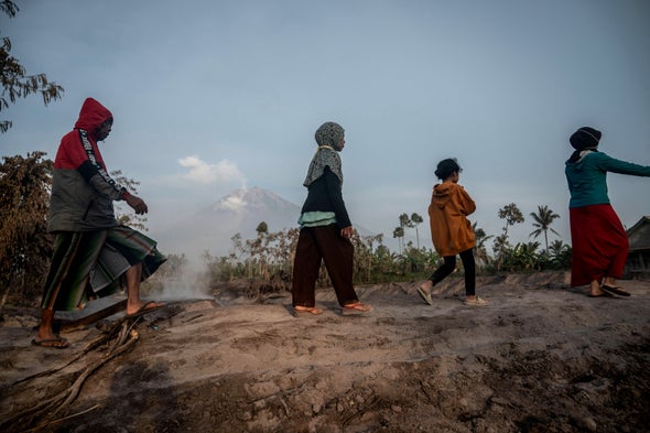
Semeru is busy, but it is not Indonesia’s most active volcano. That distinction usually goes to Mount Merapi, also on Java. But Semeru is not far behind, and the combination of ash, gases, pyroclastic flow, mud and human presence nearby make it a dangerous mountain. The ASEAN Coordinating Center for Humanitarian Assistance on Disaster Management estimates that more than 61,000 people live within 6.2 miles of the volcano. Thousands have been evacuated this time, and local authorities have warned people not to go within five miles of the summit because of the risk of “volcanic bombs,” incandescently hot stones ejected by an eruption. Authorities have also cleared a larger area on the volcano’s southeastern side, which is the direction in which the lava and pyroclastic flows have been moving. This area includes the banks of the Besuk Kobokan River: riverbeds can funnel deadly lahars over long distances.
Lahars are an omnipresent danger near Semeru, mainly because of the large volumes of volcanic material deposited high on the mountain, combined with the wet climate of Java. These flows occur here every wet season, with 80 percent triggered by rainstorms. And a single eruption can have long-ranging consequences: according to a 2010 paper published in Earth Surface Processes and Landforms, after a pyroclastic flow-forming eruption on Semeru, lahars are more frequent for a full five to seven years. The risk will remain particularly high for the next one to two months, the head of the Center for Volcanology and Geological Hazard Mitigation (PVMBG) at Indonesia’s Ministry of Energy and Mineral Resources told the news agency Voice of Indonesia, because heavy rains are expected to continue in the area.
Lahars can occur with very little warning, says Elizabeth Westby, a USGS geologist at the agency’s Cascades Volcano Observatory, who studies Mount Rainier in Washington State. Like Semeru, Rainier is a stratovolcano—a classic cone-shaped mountain built up by repeated eruptions—that is prone to lahars. The USGS monitors river channels in the area in order to be able to warn communities downstream if a flow is coming. “At Mount Rainier, large lahars have been associated with eruptions like the Osceola Mudflow,” Westby says, referring to a lahar that happened at the volcano 5,600 years ago. “But lahars can also begin as large landslides that occur without warning, traveling down river channels to densely populated areas downstream. The Electron Mudflow for example, which occurred about 500 years ago, was not associated with an eruption, so it is possible that a lahar could occur during quieter periods.”
Like Rainier, Semeru is part of the Ring of Fire, a belt stretching in a horseshoe shape from New Zealand to Southeast Asia, Japan and Russia and then over to Alaska and the western coasts of North and South America. In this belt, tectonic plates collide and push under one another in a series of subduction zones, giving rise to both earthquakes and volcanism.
Semeru has been in a period of frequent activity since 1967, Sennert says, and this week’s explosion is part of an eruption that has been ongoing since April 2014. (The Global Volcanism Program considers eruptions continuous unless they pause for three months or more.) It’s difficult to predict exactly what is in store for Semeru next, she says.
“I like to compare it to the weather,” Sennert says. “When a storm comes through the Midwest, how do you know whether it’s going to produce a tornado or not? There have to be certain conditions met for a tornado to form. They’re hard to forecast, and once they happen, it’s hard to know where they’re going to go or how long they’re going to last.”
 Rights & Permissions

