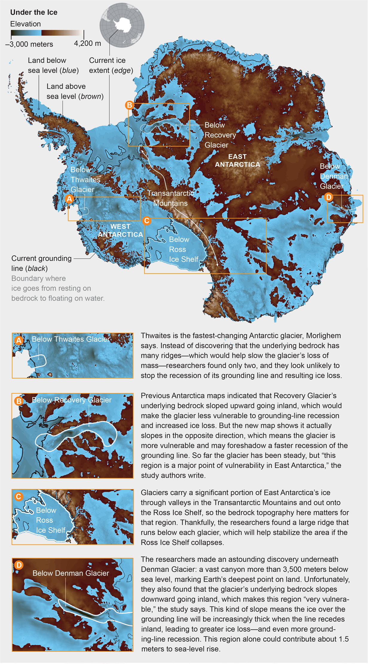
Where and how fast will Antarctica lose ice as the climate warms, and how much will the sea level rise as a result? To answer these questions, scientists must learn as much as possible about the vast continent—despite the challenge of accurately surveying its topography underneath all that ice. The contours of Antarctica’s bedrock help determine the behavior of glacial grounding lines, the zones where glacier ice transitions from resting on ground to floating on ocean water; if the line moves inland, a glacier loses more ice. Last December researchers published an upgraded bedrock map in Nature Geoscience, combining measurements from sources that included airborne radar, satellite, seismic and snow accumulation data. The team estimated the topography for gaps between radar measurements using a more accurate, physics-based method, and they found striking differences from older maps—for instance, prior bedrock elevation estimates in some areas were up to 2,000 meters off.
The new map reveals good and bad news about potential ice loss in different parts of the continent. “There is not much hope for West Antarctica,” says Mathieu Morlighem, the study leader and an earth system scientist at the University of California, Irvine. “But East Antarctica is a mixed picture.” The study fills in crucial knowledge gaps about the continent’s bedrock topography, says Jonathan Bamber, a glaciologist at the University of Bristol in England, who was not involved in the map project: “This is going to make our projections and simulations that much better for predicting sea-level rise.”